
The Latest News from PA Chapter of APA…
Stories, Change, and Staying the Same in Lancaster County: An Interview with Kip Van Blarcom, AICP
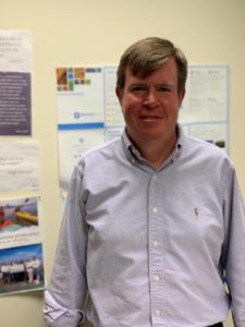 Kip Van Blarcom is a Senior Planner with the Lancaster County Planning Commission, where he’s worked for over 20 years on planning for development impacts to historic resources and heritage tourism. He now serves on LCPC’s new Technical Services Team. In a strange twist of fate, Kip was born in Iceland. He grew up in Kansas City and Minnesota. After a thoroughly Midwestern upbringing, he moved to the East Coast to attend a graduate program at the University of Delaware and later to Lancaster, PA, to work at LCPC. He has stayed in Lancaster ever since, enjoying the area’s rich connections to early American history.
You have a strong interest and background in history. Given that, how did you come to planning as a career?
I have always wanted to know how places have become the way that they are, which led me to study American history. The planning profession is a natural extension of that interest because it looks at where a place is going. Studying the past made me realize that you need to take action in the present to get where you want to be as a community – and that’s planning in a nutshell.
When I was a kid, I wanted to be a Foreign Service officer and even did a summer program in Turkey. I eventually saw that I really wanted the ability to invest in a particular place, which isn’t what the Foreign Service is built to do on an individual level. Planning does allow me to do that, to focus on one place as it changes and grows.
As a card-carrying member of Gen X, how do you approach technological innovations in the workplace?
2020 has really pushed planners – and many other professions – to rely on virtual meeting technology. Looking at the past and how big changes in cultures come about, I look at those instances and think that I want to be the person who figures out how to use something new. Maybe not as an early adopter, but not as a person who ignores it and hopes it goes away, either. You have to do it on your terms. I can stick to the principles of good planning while being open to different ways of doing things. This is where planners and planning organizations should really recognize and value the role of younger colleagues in challenging us not to be stodgy. LCPC has heard a lot lately, for example, about how we need to produce more video content. Traditional forms of public engagement are becoming harder and harder for people to relate to and we can’t disregard that because we don’t know how to create the outreach that does work.
What do you consider the single biggest way technology has transformed your job for the better?
This is probably a generational thing, but email was truly transformative. The telephone as a primary way of exchanging information had a lot of pitfalls. I can now see communication evolving once again into platforms that incorporate live chats, virtual meetings, project management functions, and file sharing. This shift is likely to be just as transformative.
How about the worst?
Technology in a variety of forms contributes directly to information overload, especially for planning managers. People literally get hundreds of emails per day. There used to be times when you couldn’t be reached and we don’t have that luxury anymore. That adds so much stress to our workload. Planners have to find new ways to prioritize work and organize tasks.
In an era of quickly evolving technology and big data, what do you see as a key role for planners?
Creating stories. Many planners are very technical people and tend to look at places and people as data, b
ut forget to identify the story behind it. The story is the part that people will engage with; you have to make information and data relatable. This is where planners can take a page from historians. Think like a museum curator. When faced with a large collection, curators identify the most important and engaging stories that can be told and present those in a creative, visual, interactive way. Planners should not be afraid to do this when the situation calls for it. Interpretation is an underemphasized part of analysis. It’s OK to have a viewpoint as a planner.
How has LCPC adapted to the pressures you have mentioned?
Scott Standish, our Executive Director, recently undertook a strategic planning process to look at exactly this
question. The planning effort has led to an organizational restructure that puts all of our technical staff together on one team: graphics people, GIS technicians, analysts, everyone. This is meant to facilitate a full spectrum of information gathering and data collection, data analysis and mapping, and the building of meaningful stories rooted in all of that. This same restructure has moved all of the functional planning areas – housing, transportation, land use, open space – to a single team. These changes let us work better with the people we have and help us forge a unified voice, one that maybe wasn’t as strong or as clear before.
Where might we find you when you’re not working?
I have been walking all over Lancaster County for about six years now. It began when I checked out an interpretive sign for a covered bridge installed as part of a planning project I worked on. I realized I could start at one end of the bridge, walk a loop of the local roads and end a few miles later at the other end. Since then, I’ve walked a 4-5 mile loop every Saturday and Sunday most weekends. At this point I’ve done hundreds of loops and visited every municipality in Lancaster County. I’m an experiential learner and this is how I have always connected to the places I live. When I’m working with a specific place, I can think back and remember  what the weather was like w\hen I was there, the vistas I photographed, the odd encounter I had with wildlife, what I ate. At a walking pace you can really observe a location, choose your angle for a picture, and wait for the light to change. This is my way of building my own personal story with a place; it helps me as a planner to stay grounded in a sea of statistics and maps.
What three words best describe you?
Observant. Inquisitive. Talkative. As you can tell.
To celebrate GIS month, we wanted to highlight how Planning Departments in Pennsylvania utilize GIS and drones to improve their planning practices. The APA recently published a Planning Advisory Service Report 597 entitled, Using Drones in Planning Practice. This report highlights how drones can be used and incorporated into planning practices. These include photo simulations, community engagement, environmental assessment, and planning studies. Below are a few examples of how local agencies have used drones to improve their ordinances.
In 2017, the Tri-County Regional Planning Commission (TCRPC) partnered with Shippensburg University and Susquehanna Township to analyze the impact of parking formulas on development. Utilizing drones, staff and students from Shippensburg’s GIS program gathered data from a mix of commercial uses, including retail strip shopping centers, fast food, and commercial office buildings, to assess off-street parking conditions in the Township. Aerial photographs were collected with a small Unmanned Aviation System over properties that agreed to participate in this parking study. Every effort was made to collect imagery during peak hours on peak days, including the “Black Fridays” in November 2017 and 2018, and during the 2018 back-to-school shopping season. Each set of photographs was stitched into a mosaic, which can be used for counting the number of unused parking spaces in each area at a particular moment in time. This information was then used to analyze the existing parking standards and propose new standards, including parking maximums. More details about this project are available here: https://arcg.is/11zjXL.
Another project utilizing drone data was a partnership with the Center for Watershed Protection, Inc., the Water Science Institute (WSI), and the Paxton Creek Cooperative. The Paxton Creek Restoration Project Prioritization was funded through a NFWF Grant. WSI was subcontracted to perform LiDAR differencing of the Paxton Creek Watershed to create a “hotspot” map and measure sediment transport through the watershed (erosion and deposition). Drone analysis was performed over the existing creeks to refine the error in measurement. The resulting information was used to verify where the highest levels of erosion and deposition were occurring within the watershed to prioritize streambank revitalization projects as part of the MS4 permit requirements.
While many communities are aware of drones’ value, staff typically does not have the time or money to invest in drone usage. However, local universities are investing in technology and training students to use drones for planning studies. If you have a project in mind but are unsure where to start, reach out to your local university’s geography program to get more information. This provides an excellent opportunity for students to engage in current planning projects and for agencies to be supported by the newest drone technology.
Great Places in Pennsylvania Spotlight
 The Great Places in Pennsylvania program began in 2014. This program highlights places in the Commonwealth that are prime examples of good planning and are centerpieces of their communities highlighting connectivity, community engagement and economic opportunity. Each month, we will highlight a recent Great Places award winner.
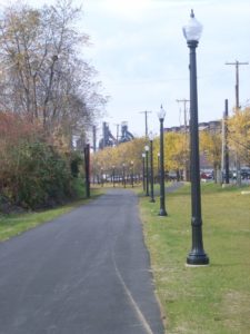
In 2019, the South Bethlehem Greenway was recognized as a Great Place in the Great Transformations category. The South Bethlehem Greenway is a linear park that extends over a mile through South Bethlehem. Originally a railroad corridor for both freight and passenger rail, the land became blighted following the closure of Bethlehem Steel and the abandonment of the rail line. The City of Bethlehem began plans to develop the Greenway in 2005 and purchased the property in 2008.
The development of the Greenway was guided by the South Bethlehem Greenway Master Plan which was completed in 2005, following a series of public meetings. As part of the master plan development, the consulting team collected and analyzed data on the Greenway by photographing and walking the corridor. They used the data to develop a series of site plans covering different parts of the Greenway.
Today, the South Bethlehem Greenway is a community gathering place and an economic driver for South Bethlehem. Several local festivals are hosted on the Greenway and nearby restaurants have created a direct connection to the Greenway. Residential development near the Greenway has also occurred to take advantage of this community amenity. To learn more about the City of Bethlehem, visit https://bethlehempa.org/.
Chapter Award Highlight – DVRPC’s Bike-Friendly Resurfacing Project
At the Chapter’s 2020 Virtual Planning Conference, DVRPC won an award for their Bike-Friendly Resurfacing project. This ingenious and cooperative project screens road segments that appear on PennDOT’s 5-year resurfacing plan for the potential addition of bike lanes, striped shoulders, or sharrows. Using GIS network and spatial analysis tools, DVRPC conducted a regional Bicycle Level of Traffic Stress (LTS) and Connectivity Analysis on the regions roads. This information was then used to identify and rank road segments where bicycle facility improvements would provide local and regional connectivity benefits to the low-stress bicycle network. Learn more about this project and Chapter award winner at https://www.dvrpc.org/Transportation/Bicycle/BikeFriendlyResurfacing/

Here’s a friendly reminder to register for our “Webinar Wednesday” event on December 2, 2020 from 12:00 p.m. to 1:30 p.m. We are excited to bring you Micromobility Challenges: Sometimes You Feel Like a Scooter and Sometimes You Don’t presented by Roy Gothie and Ngani Ndimbie with PennDOT. CM Credits will be available, and the webinar is free for Chapter Members and $20.00 for non-members. The Chapter would like to thank Alexis Williams, Chapter Professional Development Officer, for all of her hard work in developing the Chapter Webinar Wednesdays’ program. We are excited to offer you the following sessions in the upcoming months:
-
- Hello, It’s Me: Introducing PA-SHARE with Elizabeth Rairigh | January 6, 2021
- Planning and the New Dynamics of the Demographic of Grandparents Raising Grandchildren Growth with Howard Grossman | February 3, 2021
- Planning with a Purpose…and Need: Connecting with PennDOT and FHWA to Build the Foundation for Sound Transportation Projects with Scott Duncanson | March 3, 2021
- Planning at the Intersection of Technology, Growth, Revitalization and Inclusion with Becky Bradley | April 7, 2021
If you have topic ideas or would like to sponsor Webinar Wednesdays please feel free to reach out to us at info@planningpa.org.