
Posted on January 28, 2022
Planners at Home & on Vacation: Ending 2021 in Centralia PA & Weiser State Forest
ArchivePlanners at Home & on Vacation: Ending 2021 in Centralia PA & Weiser State Forest
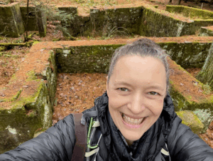
New Year’s Eve Day exploration of the homestead ruins along the Homestead Trail, Weiser State Forest.
Centralia is the kind of town that really makes an impression on a planner. First of all, if you’re not familiar – it’s barely there anymore. It’s in Columbia County, the heart of PA’s anthracite coal region. It caught on fire underground, decades ago, and continues to burn. Most of the residents are long gone and large open mines line the roads between towns. It’s highly apocalyptic.
So, of course, this is where my husband and I – both planners – picked as a day trip destination on the last day of 2021, itself a somewhat
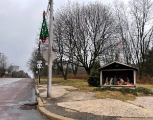
Main crossroads in Centralia, PA
apocalyptic year. Centralia invites you to drive along cracked streets no longer lined with houses. It causes you to wonder about the people who remain, especially the ones spirited enough to decorate the town ‘square’ for Christmas. One stub street ends at a lonely cemetery and others peter out in moonscapes full of dirt bikes, gas vents, and off-road vehicles. A church with graceful onion domes – signs of a Ukrainian Catholic congregation – overlooks the bare crossroads that mostly counts as ‘town’ these days.
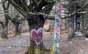
Near the edge of town, where in years past the highway itself split open and spit flames. |
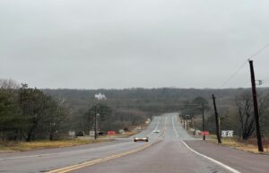
As close as it gets to a town square. |
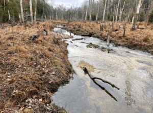
South Fork of Roaring Creek as it flows through Weiser State Forest.
If you drive north through neighboring Aristes and over the ridge of Big Mountain, though, you’ll find a very different landscape. The Roaring Creek Tract of Weiser State Forest is in many ways the greener, more peaceful side of Centralia’s extractive, industrial coin. While my husband and I were wandering for miles on the Homestead Trail through the Roaring Creek’s long and narrow valley, we wondered why it hadn’t been touched much by development. Information available at park headquarters filled us in: a series of private water companies have owned the land since the 1880s. Several reservoirs were constructed but most other activities were limited. Fortunately for us, in the early 2000s, PA DCNR acquired the land. A water company retains facilities, dams, and reservoirs while the land is jointly managed as a high-quality water supply. Of note is the 8-mile Roaring Creek trail, a hardened trail following the valley floor that is popular with walkers, joggers, and bicyclists.
All photos courtesy of Amy & Justin Evans; article by Amy Evans