
by Amy Evans, AICP and Chat GPT
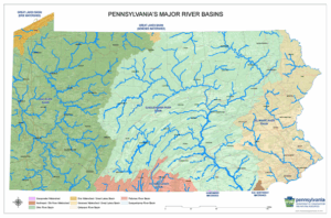
The diverse landscapes of Pennsylvania are home to some of the nation’s most captivating watersheds. These intricate networks of rivers and streams not only sustain the state’s rich biodiversity but also play a vital role in shaping its cultural and economic tapestry. In this exploration, we dive into the major watersheds of Pennsylvania, uncovering fascinating facts about each and viewing vintage postcards that capture our riverside landscapes.
- Susquehanna River Watershed: The Keystone’s Lifeline
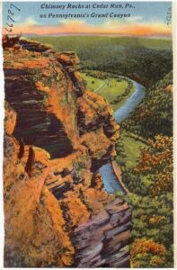
Stretching across almost half of Pennsylvania’s land area, the Susquehanna River Watershed reigns supreme as the Commonwealth’s largest drainage basin. Flowing for over 440 miles and comprising six major sub-basins, the Susquehanna not only provides water for millions but also serves as a crucial habitat for diverse aquatic species. The Susquehanna River Basin is one the most flood-prone areas in the nation, with major floods occurring every 20 years on average. The Susquehanna contributes half of the freshwater flow into the Chesapeake Bay, typically measuring around 18 million gallons per minute where it meets the Bay at Havre de Grace, Maryland. The Susquehanna watershed includes Pine Creek Gorge in Tioga County, also known as the Grand Canyon of Pennsylvania. Phosphorus pollution from manure, runoff, and sewage treatment has a significant effect on the Susquehanna’s contributing freshwater streams and ponds, as well as the Chesapeake Bay itself. Hydroelectric and nuclear power plants harness the river’s flow to aid in the production of electricity. Fun fact: The Susquehanna is the longest river on the East Coast of the United States and the longest river in the U.S. that is not commercially navigable. Its headwaters are in Otsego Lake, New York.
- Ohio River Watershed: Confluence of Beauty and Industry

Pennsylvania’s western regions are cradled by the Ohio River Watershed, a network that encompasses the mighty Ohio River and its tributaries. The Ohio River watershed is the second largest in Pennsylvania, but its land area here only accounts for one-tenth of the entire Ohio River Basin. This watershed not only fosters a stunning natural landscape but also historically served as a major artery for trade and industry. The Port of Pittsburgh is the busiest inland port in the nation and 14th busiest port in the U.S. overall. The Monongahela is a major tributary of the Ohio and ranks with the Ruhr in Germany and the Thames in the United Kingdom as one of the great industrial waterways of the world. The confluence of the Allegheny and Monongahela Rivers forms the iconic Point State Park in Pittsburgh, where the Ohio River begins its journey. The Ohio River ends in Cairo, Illinois, where it meets the Mississippi River. Fun fact: The Ohio is the only watershed in Pennsylvania to drain into the Gulf of Mexico, which contributes to a considerable diversity of aquatic species. This diversity includes 49 freshwater mussel species not found elsewhere in the Commonwealth.
- Delaware River Watershed: An Urban Treasure
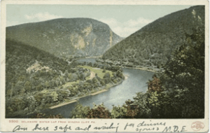
In the eastern part of the state lies the Delaware River Watershed, home to myriad ecosystems and cultural landmarks. The Delaware River watershed is home to nearly 5 million Pennsylvanians, the most of any watershed in the Commonwealth. This watershed not only supplies drinking water to urban centers like Philadelphia but also boasts globally rare freshwater tidal marshes and the nation’s first urban National Wildlife Refuge. The Delaware’s headwaters arise in the Catskill Mountains and eventually reach the Atlantic Ocean through the Delaware Bay. The famous Delaware Water Gap is a breathtaking geological formation that attracts outdoor enthusiasts with its hiking trails and stunning vistas. The Delaware River above the Water Gap is an important inland habitat for wintering bald eagles. On the other hand, the lower Delaware River is heavily industrialized, with the Delaware River Port Complex being the largest freshwater port in the world. Fun fact: The main stem of the Delaware River is the longest free-flowing, undammed river in the eastern United States. In May and June of each year, the Delaware Estuary becomes the center of one of the largest horseshoe crab spawns in the world.
- Potomac River Watershed: Where Pennsylvania Meets the Nation’s Capital Area
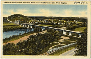
This Potomac River does not pass through Pennsylvania, but many tributaries flowing south out of the Commonwealth send waters to the Potomac through the neighboring state of Maryland. At Hancock, Maryland, the Potomac comes within two miles of the Pennsylvania border, giving it the narrowest non-vertex border-to-border distance of any U.S. state. As the Potomac itself flows southward, it becomes a major tributary of the Chesapeake Bay, second in volume only to the Susquehanna. Three Pennsylvania state parks lie in the watershed: Buchanan’s Birthplace, Caledonia, and Mont Alto, all in Franklin County. The Potomac River has played a crucial role in American history, serving as a transportation route during colonial times and witnessing pivotal moments during the Civil War. Fun fact: Falling Springs Branch Creek in the Cumberland Valley near Chambersburg is one of only three designated limestone wild fisheries in the Commonwealth.
- Great Lakes Watershed: Erie & Ontario Connections

Connecting Pennsylvania to the vastness of the Great Lakes, the Lake Erie Watershed holds both environmental and recreational significance. The lake and its tributaries support diverse ecosystems and offer recreational opportunities for residents and visitors alike. Lake Erie is the shallowest, warmest, and most biologically productive Great Lake and is considered the best walleye fishery in the world. Presque Isle State Park, a unique natural feature near the City of Erie, boasts the only coastal beach in PA and the picturesque Presque Isle Lighthouse. Pennsylvania also captures a small portion of the Genessee River watershed in northern Potter County, the only land area in the Commonwealth that drains to Lake Ontario. Not-so-fun fact: In past decades, the pollution-driven algal blooms on the beaches of Lake Erie were so detrimental in their impacts to native fishes that they earned a mention in Dr. Seuss’s The Lorax.
Watershed Wonder
Pennsylvania has more miles of streams than any other state except Alaska, estimated at over 86,000 miles of waterways. From the Susquehanna’s meandering path to the cultural importance of the Delaware, these watersheds underscore the interconnectedness of water and human life. Exploring each watershed not only deepens our understanding but also fosters an appreciation for the intricate web of life flowing through the Keystone State.
“You’re glumping the pond where the Humming-Fish hummed.
No more can they hum, for their gills are all gummed.
So I’m sending them off. Oh, they’re future is dreary.
They’ll walk on their fins and get woefully weary
in search of some water that isn’t so smeary.
I hear things are just as bad up in Lake Erie.” –Seuss, The Lorax
The Pennsylvania Department of Conservation & Natural Resources’ Watershed Education site offers a variety of resources for understanding and studying streams, including a selection of watershed maps that may be printed and used for educational purposes and fact sheets for major watersheds. Fun fact: these fact sheets helped to inform this article, along with content from ChatGPT.