
Northeastern Pennsylvania Alliance Hub Site
ArcGIS Hub is an easy-to-configure, web-based engagement platform that connects the general public, partners and internal users with content such as web mapping applications, summary reports, and open data. Organizations, including counties and government agencies, have developed Hub sites to house their data layers and GIS projects in one place.
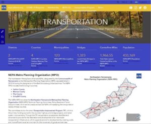
The Northeastern Pennsylvania Alliance (NEPA) is a regional community and economic development agency serving the seven counties of Northeastern Pennsylvania. NEPA is also a Metropolitan Planning Organization (MPO) providing transportation planning services to four counties. Last year, NEPA’s GIS staff developed a Hub site to house COVID-related data and information in one place for the public to access.
NEPA expanded on the Hub site to communicate, collaborate and share data with local governments, small businesses, and nonprofit organizations. NEPA’s Hub site also provides information and data about transportation projects in the NEPA MPO region. Learn more.